
Hillforts - A fan site
.
Sometimes you have to press enter/ return key, on your keyboard on the address bar to go to a page after you pressed on it's link.
The Mull of Galloway, is a geographical location that is the most southerly point in Scotland.
Well the strange fact about Scotland’s hillforts, just like with England and Bindon hillfort, is that the largest enclosure in Scotland is not a imposing high banks site, that sets many imaginations thinking of amazing battles. The largest is on the Mull of Galloway. This is the area that sits on the large Hammerhead shape peninsula on the south west of Scotland facing Ireland's Ulster, the Rhinns of Galloway as they are known . Galloway’s mainland, the area east of there itself, is full of uplands, and forest in the modern era, but the Rhinns, are very much an exterior lower, equally rural appendage of it.
On the southern edge or tip of these Rhinns, just over half an hours drive, 22 miles from the port town of Stranraer, ( the site of the natural harbour of south west Scotland to Ireland ), is a lighthouse and bird sanctuary area, of cattle and sheep. Here you can look off the coast at rocky islets and the coast of Galloway, and the birds and boats that wander across past here. I mention this location, as a not particularly glamorous looking muddy sheep covered embankment and ditch, across a area, separate 54 hectares of between 200 and 400 metre wide peninsula 1.7KM long of this the thinnest end of the Rhinns. There is no evidence that it is a Iron Age site, but it is possible it was from then or the Dark Ages. What could this southern most point of Scotland have been used for. Possibly it was just to protect farm animals from attacks, but why such a site so far from where most people and livestock on the Rhinns would be? The cliffs of this peninsula’s end, essentially forming a promontory or finger that protects off landings and attacks. There is some evidence of arrowheads, and axes, but they may be unconnected to the palisades at this site. Also who would have such a dangerous place for a centre here, it is not central to anywhere. I mean yes sea travel was often easier than land travel, but only for long distance travel. So surely few would set up a capital here in pre Roman times. Additionally surely there are better sites for trade, yes it is closer to some faraway lands, but it is so far from most Scottish, or even Galloway people, and thus trade, that overland travel to here would be worse than sending a ship further up the coast surely. Maybe of course though, it was never a settled site, perhaps, it was simply a refuge again for people and livestock, using geography for protection, to guard off attackers.
So what could it be? It could be much later than even Dark Age, it could a Viking or Roman era Raiders site, well protected and far from land or sea attackers. I mean yes you can see England, Ireland and the Manx, but only far away and on a clear day. Perhaps it was a site of Roman era raiders from Scotland into Ireland, or vice versa, or Dark Ages, or Iron Ages raiders. Or a last ditch battle site for Iron Age tribes from Rome, or somebody else. Then again anything Roman would crop up pretty well. So my best guess, is seeing the lack of finds associated with the site, it could have bits that were ancient. So Maybe it was site for a Ulster king to hide items, or a Iron Age pirate raider society, maybe a British, or Pictish site, who knows?
Or maybe like Lundy Isle, or some more townlike sites of the time in Ireland like Dublin, or indeed the Orkney Islands and such back in Scotland's realm, it was used as a base by the Vikings. I mean it would be quite central to the Viking Kingdom of Mann and the Isles. Or a Viking King of Dublin, as they had colonies and lands they claimed all over the place, for their Norse empire. Also there were apparently landowners round here, whose name derives from a Gaelic term for Danes, I mean like the Norse and Danes as Vikings terms, indicating that family for example from round here had some Viking heritage along with the Celtic heritage of here. So I mean it sounds quite a possibility a base for Viking raiders or cattle thieves and such. Or even just a nice homebase for the Vikings, or temporary base. Maybe it could be the Kings of Mann and the Isles (when they held the Inner Hebrides) or maybe those Hiberno- Norse Kings of Dublin, as the Dublin ones at times, like Echmarcach mac Ragnaill, did possibly hold the Rhinns.
Well whatever it is, if it was Dark Ages, or Roman, or Iron Age, or even more, maybe just a very late medieval, or a post 17th Century, or more recent site, whatever the case, it has some importance, seeing it is the largest enclosure in Scotland of this type. You can call it a hillfort, but it could be too recent for that.
As I say there is a Mull of Galloway Visitor centre right at the tip of this southern most most southerly tip of Scotland, well mainland Scotland, as there are some rock islets further south very nearby. There is also the Mull of Galloway lighthouse that we visited. It is more about the lighthouse and the RSPB centre here, and the enclosure does not get as much attention, as of course, it is lower down the list of interestingness to most people, but I was glad to see this highly enigmatic site on the Rhinns of Galloway. Scotland's most southerly hillfort or enclosure.
It is within the parish of Kirkmaiden, which apparently also has the small hillfort, Core Hill Fort, and Dunman Fort, which is early Iron Age site. And in addition a dun or broch called Crammag Head, which has apparently massively decreased in structure as of erosion, it being on the coast. Plus there is a motte and bailey as well, called High Drummore Motte and Bailey.
One more thing they are not spelt, The Rhins of Galloway, The Rins of Galloway, The Rinns of Galloway, The Rin of galloway, Therinnsofgalloway, The Rhine of Galloway, The Rhin of Galloway, or the Rhinn of Galloway. It is the Rhinns of Galloway. Also it is the South Rhinns not the South Rinn. So that is my page on the Mull of Galloway Enclosure.
Update in 2023 there was a excavation, which stated that parts of the trenches in the 19th century were considered recent, and parts ancient, so then the excavations found there were multiple periods of replenishments, of both sections, but that a specific date was inconclusive, names associated include Rhins Revealed webinar, Dr.Graeme Cavers, and Dumfries and Galloway Council, and AOC archaeology, and coastal communities fund. They said it was recorded as a entrenchment much of it in 1848, but part was just recorded as a field boundary. The bit I saw, was seen as a bank ditch and bank and ditch, with it in multi phases. But it turns out there is also a outer rampart at the narrowest point of the peninsula almost its neck and the promontory is a head, where the rampart if quite big and closing off the mull, it is where the narrowest part of the map of mine is just north of the rampart, described as the rampart I saw, that line, being set behind that outer rampart. I did not notice the outer rampart on my visit, though it is apparently big, I probably thought it was just mounds of dirt there, but I dont mind making that mistakes, the other but is easier to see, and more hillfort bank and ditch like. Well the 2000 CFA excavations found that the ditches used to be deeper, and there were slots for stockades in the past and palisades, with multiple phases and remodelling over time. While the outer ramparts were from a deep chunky stone wall, that was remodelled over time, the wall reminded some of Iron Age builds, so some feel it was rebuilt and abandoned over centuries, indeed the 2023 excavators felt the 1950s idea that the inner rampart was a modern field boundary, the one I have photos of, that that theory is wrong, it is older than that. The 2023 Geophys research found there may be a circular enclosure within the 2 enclosures, and may be hearths remains there, or not, this all makes me unsure if the enclosure relates to the area south of the inner ramparts or the the area south of the outer one, or the whole tip of the peninisula, I always thought it was the whole tip of the whole peninsula, but may be wrong there. But I think the term inner rampart denotes its defending a area to the south of it as well. But both ramparts have use. I thinks. It seems the general theory created by the team in 2023, was that the outer rampart, that which I did not photo, excitingly looks possibly Iron Age, and that the Inner rampart the one I did photo, looks possibly Iron Age or even Bronze Age, with both possibly being redone in the Medieval era, possibly the early medieval era. One nearby hillfort built in the Iron Age was compared to it, and the fellow Cavers stated its possible even in the 5th Century BC a enclosure had been dug across here, and possibly earlier. One questioner stated a Iron Age fort in Northern Ireland, right across the sea, was thought to be Iron Age but is now thought to be Bronze Age after excavations, so all great stuff. It was wondered by the Cavers team if the area was a harbour a portage a centre of trade for the area, with a other fort nearby also on a promontory, said to be used as a fort that brought in luxuries in the Early Middle Ages, even from the Med, such as in amphorae, it was wondered if this sight could have been similar. But that large circular enclosure in between the 2 enclosures, found by geophys, may indicate the site was a bit of a community, bringing in trade as a entrance point to trade to Galloway. Where from I am unsure, Ireland, the coasts of nearby Britain itself or further afield I am unsure. I mean I suppose trade would be needed in many places, of different metals, and luxuries, and exports could be useful as sources of income for various communities here, On what scale I am unsure, but it seems likely it had Iron Age use. So perhaps it is fair after all to call this site the biggest hillfort in Scotland. There was also thought about how to protect the site even though photographs have been uploaded for wonderful 3D models, as on the one hand if you fence it off, stuff could grow there and wreck the site, and the cows and sheep help keep such growth down, but also they trample the off bit of archaeology just as plows did historically as well. It is felt the 2 beaches on either side of the part in between the enclosures could be used as harbours, I mean its reminding me of Tintagel above the rocky coast brining in wares, but it could be of a earlier time lost to written history, trade with Ireland, or as I say the coasts of western Britain etc, or could it also have been used for the romans with their trade to Ireland, or to Scotland, though surely Roman stuff would have been found and it would have been more Roman then. What a site which likely had use right up to later, its almost strange that it lacks use today, but perhaps trade centralises to certain ports. It is felt the Isle of Whithorn to east and its fort, were a major Early Medieval import and export site for Galloway, and of course Stranraer and internal roads were later. Then again the same occurs in Southern England, what with Portsmouth and such existing today, but Hengistbury Head, being just a former site as to some others. I wonder if the coming of Christianity, and the lack of a major monastery on the Mull indicates Whithorn was used in that era, as of its Cradle of Christianity moniker, indicates this place was secondary to it then, and the lack of Roman finds indicates it was more of a Iron Age or Bronze Age site, it did not need some saga like Viking style conquest story of the area, by forces from Ireland or whatever it could just be a locally generated trade area, useful as a resource site for important resources like certain rare metals, or items for the area, and for them to export items anything from cattle to anything, to get the income to buy that stuff. So thats probably what it was, and perhaps it was used by later groups, Picts or Vikings as well. Or Romans, or Scots.
Did you know not only did the Vikings have Dublin, and Manx, but also settled a lot of North West England as well as Cumbria and Yorkshire, and the Wirral, and had overlordship over Anglesey Ynys Mon, for a short period in early 12th century, which a Welsh prince helped use against the Normans, who briefly had reached around there, by near then, I mean he let him have a lot of timber, but then it came strongly back into Welsh princes hands.
Some now say it was a site for the elite, a well protected site, for the Novantae, and they developed a comparitely good relationship with the Romans, who called it the headlands of the Novantae. . But that it was a refuge for them and their cattle.
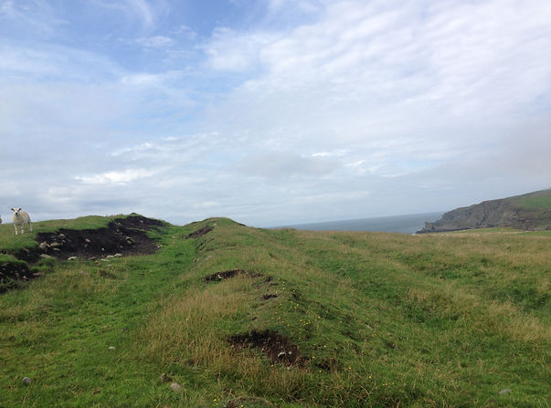
Here are my pictures and a map of the enclosure below, nobody can use these pictures without my permission.


